

Publish a QGIS map to the web, without hosting it
qgis2web gets your map out of QGIS, but you still have to host it. qgis2squidmaps skips that step: you get a link, and the map lives in your squidmaps collection.

You’ve styled a project in QGIS, and now you want people to see it on the web. For years, the answer has been qgis2web, and it’s a great plugin: it turns your project into a Leaflet or OpenLayers web map, styles and popups included.
What it gives you, though, is a folder of HTML, JavaScript and GeoJSON. Getting that folder onto the internet is up to you, and that’s where a lot of people get stuck.
The hosting step
In April 2021, someone new to web maps asked on GIS Stack Exchange, “What is the simplest way to host a qgis2web export?” They wanted to share the map with colleagues and put it in SharePoint.
The top answer is a tour of web hosting: set up an Apache server, ask your IT department for space on the company website, or rent web space and upload the folder over FTP. It ends: “I don’t know of any online, free webservice that provides you access to webspace where you can publish any content you like.”
The question is still getting answers. The newest arrived last month, more than five years later.
On r/QGIS, someone asked “How do you share the map with
others?”
They wanted the simplest way for their users, “ELI5 if possible, I’m very new to
all this.” The replies suggested an Amazon S3 bucket, GitHub Pages, a cheap web
host, and zipping the folder onto Google Drive so each person could unzip it and
open index.html themselves. A few replies in, they wrote: “Turns out it’s
pretty complicated, isn’t it?”
People ask the same thing on the QGIS mailing list, and university workshops spend a whole session on hosting a web map with GitHub Pages.
It has gotten easier. That newest answer suggests Netlify
Drop: drag the folder onto a web page and you
have a site in seconds. But you end up with a URL like
peaceful-gumdrop-4f2a1c.netlify.app. It’s one more thing to keep track of:
where it lives, which account it’s in, and which folder on your laptop was the
last one you uploaded. Make ten maps and you have ten of them.
Skip it with qgis2squidmaps
qgis2squidmaps is a free, open-source QGIS plugin that sends your layers to squidmaps instead of writing files. Choose Web ▸ qgis2squidmaps ▸ Create squidmaps map, pick your layers, and choose Create map. It opens in your browser, with a link to share.
There’s nothing to upload, and no HTML to keep.
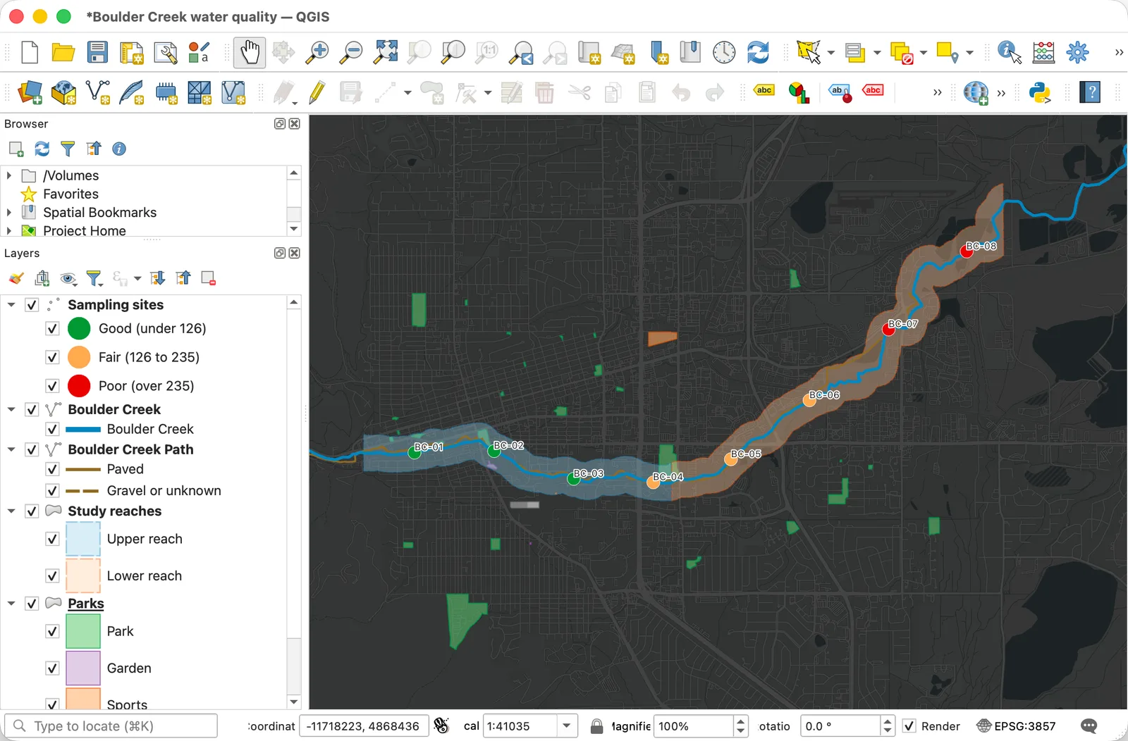
Here’s the map it made, live, so pan, zoom and click a sampling site:
The colors are the ones from QGIS, for single symbol, categorized, graduated and rule-based styles. Your layers become folders people can turn on and off, and rows in the map’s legend. The fields you choose become each feature’s popup.
Your maps, in one place, under your name
The link works straight away, for an hour after the map’s last change, with no account. Add the map to your squidmaps account and it’s yours to keep. That’s the part I care about most.
When you publish it, it gets an address like squidmaps.io/you/boulder-creek,
under your username, next to every other map you’ve made. Your profile is the
collection, so there’s no list of deploy URLs to keep. When you want to change
the map, you edit it in squidmaps, in the browser, and the link and every place
you’ve embedded it update. You don’t export and upload it again.
You also get the rest of squidmaps: basemaps you can restyle, embed code for your site, and a picture of the map to download.
Is qgis2web still the right tool sometimes?
Yes. qgis2web gives you the code. If you want to customize the Leaflet or OpenLayers page by hand, or the map has to live on your own server, that’s what it’s for. qgis2squidmaps is for when what you want is a link: a map to share, embed or come back to, without running a website for it.
The plugin doesn’t do everything yet. Points are circles for now, not marker shapes or SVG icons, and raster layers don’t come along except an XYZ tile layer as the basemap. The plugin’s page has the full list.
Try it
qgis2squidmaps works with QGIS 3.22 or later, including QGIS 4, on Windows, macOS and Linux. It’s marked experimental for now, so in Plugins ▸ Manage and Install Plugins, open Settings and check Show also Experimental Plugins, then search for qgis2squidmaps. Or download it from its page on plugins.qgis.org.
If a style doesn’t come across the way it looks in QGIS, open an issue with the layer’s style. Real projects are how the plugin gets better.